Location of Guadalest
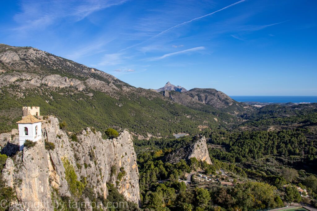
Guadalest is one of the most charming and picturesque towns in Spain, located in the southeast of the country, in the Valencia region. It belongs to the province of Alicante and is located in the Marina Baixa comarca, about 25 km from the Costa Blanca coast. Guadalest has an area of 15.97 km² and has 274 inhabitants (INE 2023), making it one of the smallest municipalities in Spain in terms of population.
Guadalest is located in a gorge between the Aitana and Xortá mountains, which are the highest peaks in the entire province of Alicante. The town is situated at an altitude of 595 m above sea level and is surrounded by a beautiful mountainous and lake landscape. In the center of the village, there is a reservoir, which was created as a result of the construction of a dam on the Guadalest river in the 17th century. This reservoir supplies water to the entire Marina Baixa area and is one of the largest in the Valencia region. From its shores, you can admire amazing views of the mountains and Guadalest castle.
You can get to Guadalest by car, bus, or bicycle. The CV-70 road connects Guadalest with other towns in the valley, such as Benimantell, Benifato, and Polop de la Marina. From the Costa Blanca coast, you can reach Guadalest by the CV-755 road, which runs through Callosa de Ensarriá and Bolulla. Buses run daily from Benidorm and Altea to Guadalest, stopping along the way in other towns. Cyclists can use numerous bike trails that lead to Guadalest, both from the coast and from the mountains.
Guadalest is the perfect place to spend a day or a few days if you want to get to know one of the most beautiful and charming towns in Spain. It is also an excellent base for exploring other attractions in the area, such as nature parks, mountain villages, caves, waterfalls, or beaches.
